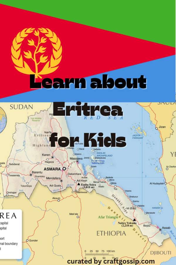
Eritrea, or formally the State of Eritrea, is a country in East Africa that’s bordered by Ethiopia, Sudan and Djibouti as well as the Red Sea. Let’s learn more!
Eritrea Basics
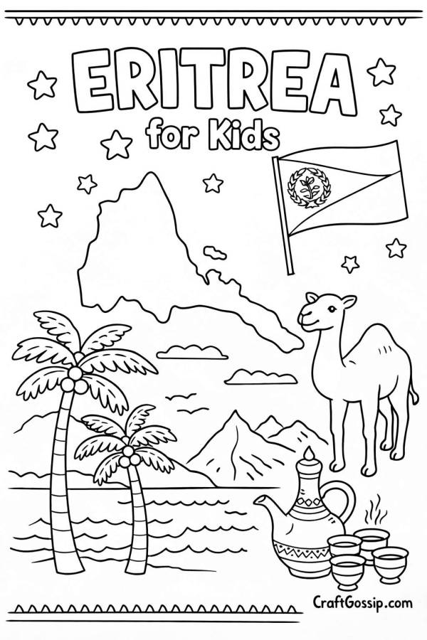
Eritrea is not just made up of the land on the continent; it also includes the Dahlak Arcipeligo and some of the Hanish Islands. The total area of the country is about 45,406 square miles (117,600 square kilometers).
For some reason I can’t determine, population estimate vary widely, with a range of about 3.6 million to 6.2 million. (I tend to agree with the 6.2 million listed on the World Factbook, may it rest in peace). Either way, about half are of the Tigrinya ethnic group and 30 percent are Tigre.
The most popular religions are Sunni Muslim and Eritrean Orthodox Christian, though it’s up for debate exactly how many people in the country practice each.
The capital and largest city is Asmara, and most people live in the center of the country and around the bigger cities.
The oldest hominid remains found in the area are a million years old, and the Kingdom of Aksum, established in the first or second century, was considered a great world power at the time.
The name Eritrea comes from the Greek name for the Red Sea, which was the Erythraean Sea.
Parts of Eritrea came under Italian control starting in 1885, eventually becoming Italian Eritrea in 1889. The country went under British military administration in 1942 and was meant to be self-governing after a United Nations declaration in 1952, except that they would be joined with Ethiopia for foreign affairs and defense for 10 years. Instead, Ethiopia annexed Eritrea in 1962 and a war of independence went on until 1991.
The country officially became independent in 1993.
There is no official language in Eritrea, but there are nine recognized languages, including Tigrinya, Tigre and Arabic. Tigrinya, Arabic and English are considered the working languages in the country.
It has a one-party presidential republic system of government that is basically a totalitarian dictatorship, and it has had the same president since independence in 1993. There have never been elections for president or the national legislature.
It is considered one of the least developed nations in the world and its human rights record is among the worst in the world.
Eritrea National Symbols
The Eritrean flag features three isosceles triangles, one green, one red and one blue. Inside the red triangle is an olive branch and a wreath with 30 leaves, representing the country’s 30-year struggle for independence. Green represents agriculture and livestock, red the shed blood from the independence struggle, and blue for the sea. The colors and layout are derived from the flag of the Eritrean People’s Liberation Front, and it was adopted in 1995.
The national anthem is “Ertra, Ertra, Ertra” (or “Eritrea, Eritrea, Eritrea), which was adopted in 1993.
The emblem of the country is different from the symbol on the flag. It features an olive branch wreath with a camel in the center, and a blue banner at the bottom with the name of the country in Tigrinya, English and Arabic. The camel is a symbol as it was used as a beast of burden during the war for independence.
Those are the only national symbols mentioned by the Ministry of Information.
Eritrea Learning Activities
Did you know Eritrea has two volcanoes considered active? While Dubbi last erupted in 1861, Nabro erupted in 2011. The 5.7 magnitude eruption caused a large ash cloud. Now’s a great time to pull out your volcano learning activities, or learn about what a volcano is. The country also has mountains and deserts if you have resources about those climates. In fact the country is said to have “3 seasons in 2 hours” because you can travel from Asmara in the mountains to sea level to the desert in that time.
When Ethiopia controlled the country, its emperor, Haile Selassie, had an Imperial Palace in Eritrea on Taulud Island. The structure was heavily damaged in the war, but I found this cool video that shows what is left of the palace.
Learn more about Asmara, a UNESCO World Heritage site because it is “an exceptional example of early modernist urbanism.” This website has some history and cool old photos.
Get fact sheets, worksheets and other activities about Eritrea from KidsKonnect. You’ll find lots of activities including coloring pages, information about the war, history and more from Teachers Pay Teachers. There’s also a nice Eritrea unit study from Teach and Print on Etsy, and another (that looks like it would be for younger kids) from Beyond ImaginationP.
Eritrean food is naturally similar to Ethiopian food, and often consists of thick stew, spicy meat dishes and vegetables. Utensils are not commonly used so food is eaten with bread like injera. Check out a recipe from injera from Daring Gourmet, and try it with zigni, considered the national dish. It’s a spicy beef stew with tomatoes, and you can try this recipe from Taste Atlas.


Leave a Reply